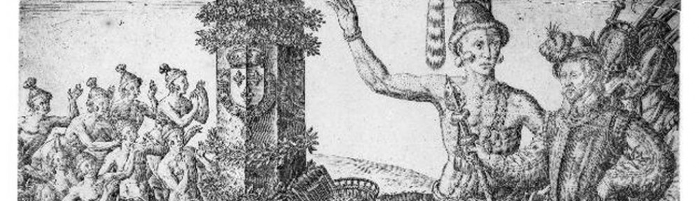
Antonio de Herrera y Tordesillas, court historian for King Phillip II, III, and IV, was a respected and prolific writer during Spain’s Golden Age. His works almost exclusively center around the exploration of the new world, with particular emphasis on descriptive accounts and a “discriminating, if not sometimes hasty, use of official evidence” (Aram 345). Herrera relied wholly on official documents to develop his writings, as he never made the arduous journey to the Americas, preferring to write among his contemporaries in Pamplona and Madrid, all while securing his place within Spain’s court. Originally Herrera worked as a notary, but soon found that “solemn dignity” as a practitioner “of a true history” and subsequently gained widespread recognition for his voluminous work.
The selection below comes in two parts. The first, from Historia general de los hechos de los Castellanos en las Islas y Tierrafirme del Mar Océano, provides an overview account of the Indies, and includes a brief selection on De las Indias del Norte. The chapters “De la demarcación y division de las Indias occidentales” and “De las India del Norte” promote nationalistic pride for the Spanish crown and reflect the reverence held for conquistadors, even as they show restraint and objectivity in voice. The second part recounts Juan Ponce de Leon’s ill-fated expeditions in la Florida, one (albeit important) episode of the larger work. The Ponce selection, translated by Florence P. Spofford, was taken from a documentary survey by T. Frederick Davis. In both selections, paragraph breaks have been added for readability.
Michelle Hendrix, University of South Florida St. Petersburg
Suggested Reading
Aram, Bethany. “From The Courts To The Court: History, Literature, and Litigation In The Spanish Atlantic World.” Colonial Latin American Review 21:3 (2012). 343-364.
de Herrera y Tordesillas, Antonio. Historia general de los hechos de los Catellanos en las Islas y Tierrafirme del Mar Océano. Madrid: The Academy of History, 1934.
__________ . Historia general de los hechos de los Castellanos en las islas y tierra firme del Mar Oceano. From T. Frederick Davis (ed.), “Ponce de Leon’s First Voyage and Discovery of Florida.” The Florida Historical Society Quarterly 14:1 (July 1935).
Macphail, Eric. “Anthony Grafton, What Was History? The Art Of History In Early Modern Europe.” The Comparatist (2012). 316.
Valero Moreno, Juan Miguel. “Herrera En Contexto: A Proposito De Una Nueva Edicion De La Disputa Contra Aristoteles Y Sus Seguidores.” Bulletin Of Hispanic Studies 7 (2010). 863.
Wagner, Henry Raup. Antonio De Herrera, Historia General De Las Indias Occidentales. n.p.: Berkeley, 1924.
“Chapter 1: The Demarcation and Division of the Western Indies”
The reach of the earth is three-hundred and sixty degrees which are reduced to six-thousand three hundred Castilian leagues [4.19 km]. The scope of land includes the sea along with it. These elements form the globe whose convex surface is partly land and partly sea. The ancients divided the land into three parts and gave each part a name. The first was called Europe, which was celebrated like no other. The second was Asia, which is larger than the others and contains the Great Kingdom of China. The third part is Africa.
Men with limited means, who believed the world had more to offer, and were not content with their limitations, learned the art of sailing. The invention of sea-faring ships accommodated them so that they could suffer the force of the waves of the sea, and in this art have led the Spaniards to all nations of the world. Reigning in Castile and Leon, the enlightened catholic King Ferdinand V and the prudent Queen Isabel, and reigning in Portugal, Juan II, known as The Pelican[1], who will always be worthy of memory; Christopher Columbus, first admiral of the Indias, having lived many years, domiciled and married in Spain, under the advice of Martín of Bohemia, a Portuguese native of the island of Faial, a famous astrologer and judiciary, and other with whom Columbus communicated; the above mentioned are responsible with the discovery of a quarter of the world. Columbus, carrying the burden and leaving Palos, Villa del Conde de Miranda, in the coast of Andalucia, and sailing the ocean that found this great land that cut through the equator and goes southward, reaching fifty-two degrees below the Arctic Pole, not knowing the end of the land.
The greatness of this quarter of the world is reflected in the admiration of the people whose descriptions were here under the name of the Islands of Tierrafirme and Mar Océano, being surrounded by the sea and the sunsets to the West, and commonly called the West Indies and the New World and fall within the demarcation of the Kings of Castile and Leon, a hemisphere and half the world, a hundred and eighty degrees of longitude west of the meridian of Toledo, which is at the mouth of the river Maranon, and east of the city of Malacca; so that travelling twenty leagues per degree has this demarcation of crossing from one party to another, three thousand nine hundred Castilian leagues, each three thousand and nine hundred Castilian leagues, each of three thousand steps, a five foot rod Castilian, who say they are Italian, are sixty miles from west to east, says seafarer Leste Oeste; and according to Ptolemy is twenty miles, shared in this opinion by many curious, still others thought it was the miles of each grade was equal to seventy, but to use seventeen Castilian leagues, you will have the truest account.
“Chapter 4: The Indies of the North”
Having divided nature into two parts, these were Western Indies, and the isthmus or narrow portion of Portobelo, Panama; putting one north and the other at noon, thus the Indians called North and noon. The kings of Castile and Leon, with the consent of the Supreme Council of the Indies, have ordered that each party has a viceroy with governors and bishoprics, who will give audiences to the people.
And first they were North Indies, commonly called New Spain, because as the first discoverers, who were Juan de Grijalba and his companions, had not seen on the islands houses of stone or other things familiar to Spain, but there they found a people, who were dressed and political, and called the land New Spain. Which exceeds the other part of the Indies on pasture, and for this there are countless cattle of every kind and also many crops and fruits; no wine because grapes do not usually season with perfection, not letting down ripening rains in July and August. Windward Islands also have large pastures and beautiful views, because all year are green and flowery, very fresh, with large forests, which are very dense and thick with trees, and in the valley there are large lagoons and marshes. They have not been seen with bread and wine, because the land has not yet matured. The rivers have the most gold. La Florida, Nicaragua, and Guatemala thus are almost like this, and everything will go, particularly, in the table referring to these islands of the north.
from Davis, “Ponce de Leon’s First Voyage and Discovery of Florida.”
…. Juan Ponce de Leon, finding himself without office, on account of Juan Ceron and Miguel Diaz having been restored to those of the island of San Juan, and seeing himself rich, determined to do something by which to gain honor and increase his estate; and as he had news that there were lands to the northward, he resolved to go to explore toward that part; for which he armed three vessels, well provided with food, men and mariners, which for the purpose of discovery are most necessary. He sailed from the island Thursday, in the afternoon, the 3rd of March, setting out from the harbor of San German. He went to Aguada, in order to set from there his course. The night following he went out to sea, northwest a quarter by north, and the vessels went eight leagues of a day’s run, before the sun rose. They sailed on until on Tuesday, the 8th of the said month, they came to anchor at the banks of Babueca, at an island that they call El Viejo, which is in twenty-two and one-half degrees [latitude]. Next day they anchored in an islet of the Lucayos called Caycos. Soon they anchored in another called La Yaguna, in twenty-four degrees. On the 11th of the same month they reached another island called Amaguayo, and there they remained for repairs. They passed on to the island called Manegua, which is in twenty-four and one-half degrees. On the 14th they reached Guanahani, which is in twenty-five degrees and forty minutes, where they made ready one ship to cross the Windward gulf of the islands of the Lucayos. This island Guanahani was the first that the admiral Don Christoval Colon discovered, and where, in his first voyage, he went ashore and named it San Salvador.
They set out from here, running Northwest, and on Sunday, the 27th, which was the day of the Feast of the Resurrection, which commonly they call [the feast] ‘of Flowers’, they saw an island but did not examine it. And Monday, the 28th, they ran fifteen leagues in the same direction, and Wednesday went on in the same manner, and afterward, with bad weather, until the 2nd of April, running West-Northwest, the water diminishing to nine fathoms, at one league from land, which was in thirty degrees and eight minutes [latitude], they ran along beside the coast seeking harbor, and at night anchored near the land in eight fathoms of water. And believing that this land was an island, they named it La Florida, because it had a very beautiful view of many and cool woodlands, and it was level and uniform; and because, moreover, they discovered it in the time of the Feast of Flowers [Pascua Florida], Juan Ponce wished to conform in the name to these two reasons. He went ashore to get information, and take possession. On Friday, the 8th, they set sail, running in the same direction: and Saturday they sailed to the South a quarter by Southeast; and keeping the same course until the 20th of April, they discovered some huts of Indians, where they anchored: the day following, all three vessels following the seacoast, they saw such a current that, although they had a strong wind, they could not go forward, but rather backward, and it seemed that they were going on well; and finally it was seen that the current was so great it was more powerful than the wind. The two vessels that found themselves nearest the land anchored, but the current was so strong that the cables twisted; and the third vessel, which was a brigantine, which was farther out to sea, could find no bottom, or did not know of the current, and it was drawn away from land, and lost to their sight, though the day was clear with fair weather.
Here Juan Ponce went ashore, called by the Indians, who immediately tried to take the boat, the oars, and the arms. In order not to break with them, they suffered it to cause trouble in the land. But, because they struck a seaman in the head with a stick, from which he remained unconscious, they had to fight with them; they, with their arrows and armed shafts — the points of sharpened bones and fish spines — wounded two Spaniards, and the Indians received little hurt. The night separating them, Juan Ponce regathered the Spaniards after hard work. He set out from there to a stream where he took water and firewood, and stayed awaiting the brigantine. Sixty Indians went there to hinder him. One of them was taken for a pilot, and so that he might learn the language. He gave this stream the name of La Cruz and he left by it a cross hewn from stone, with an inscription; and they did not finish taking water, because it was brackish.
On Sunday, the 8th of May, they doubled the cape of La Florida, which they named Cabo de Corrientes, because the water ran so swift there that it had more force than the wind, and would not allow the ships to go forward, although they put out all sails. They anchored behind a cape close to a village called Abaioa. All this coast from Punta de Arracifes as far as this Cabo de Corrientes runs north and south a quarter by southeast, and it is quite clear with a depth of six fathoms; and the cape is in twenty-eight degrees and fifteen minutes. They sailed on until they found two islands to the south in twenty-seven degrees. The one having an extent of one league they named Santa Marta, and there they found water. On Friday, the 13th of May, they hoisted sail, running along the coast of a sandbank and reef of islands as far as the vicinity of an island that they named Pola, which is in twenty-six and one-half degrees, and between the shoal, the reef of islands, and the mainland, the open sea extends in the form of a bay. On Sunday, the day of the Feast of the Holy Spirit, the 15th of May, they ran along the coast of rocky islets ten leagues, as far as two white rocky islets. To all this line of islands and rocky islets they gave the name of Los Martires because, seen from a distance, the rocks as they rose to view appeared like men who were suffering; and the name has remained fitting, because of the many that have been lost there since. They are in twenty-six degrees and fifteen minutes.
They continued sailing, sometimes to the North and at other times to the Northeast, until the 23rd of May, and on the 24th they ran along the coast to the south (not trying to see if it was mainland) as far as some islets that extended out into the sea. And because it appeared that there was an entrance between them and the coast for the ships, in order to take on water and firewood they stayed there until the 3rd of June, and careened one vessel called the San Christoval. And at this time Indians in canoes repaired there to reconnoiter the Spaniards for the first time. They saw that the Spaniards did not go ashore, although the Indians called them when they raised an anchor to repair it and they thought that they were going away. They put to sea in their canoes and laid hold of the cable to carry away the ship; for which the bark was sent among them and, going ashore, they took four women and broke up two old canoes. At other times when they repaired there they did not come to a rupture, because they saw no disposition [toward it] but they traded skins and guanin [low gold].
On Friday, the 4th, while awaiting wind to go in search of the chief Carlos, as the Indians on the ships said that he had gold, a canoe came to the boats; and an Indian who understood the Spaniards, who, it was believed, must be from Hispaniola or from another island of those inhabited by the Spaniards, said that they should wait, as the chief wished to send gold in order to trade. And while waiting there appeared at least twenty canoes, and some fastened together by twos. Some went to the anchors, others to the ships, and began to fight from their canoes. Not being able to raise the anchors they tried to cut the cables. An armed bark was sent against them and made them flee and abandon some canoes. They took five and killed some Indians and four were captured. Two of them Juan Ponce sent to the chief that they might tell him that notwithstanding they had killed a Spaniard with two arrow wounds he would make peace with him. The following day the bark went to sound a harbor that was there, and the party went ashore. The Indians arrived and said that the next day the chief would come to trade (but it was a deception). Meanwhile the people and canoes gathered together, and at 11 eighty men in breech-clouts appeared on the ship that was nearest. They fought from the morning until the night without hurt to the Spaniards, because the arrows did not reach them, while on account of the crossbows and artillery shots they dared not draw near, and in the end the Indians retired.
The Spaniards after having stayed nine days, on Tuesday, the 14th, resolved to return to Hispaniola and San Juan, with the intention of discovering on the way some islands of which the Indians that they carried gave them information. They returned to the island, where they took water, and they named it Matanca, from the Indians that they killed. On Wednesday they went in search of the eleven rocky islets that they left to the west. On Thursday and Friday they ran in the same direction until, on Tuesday, the 21st, they reached the rocky islets, which they named Las Tortugas, because in one short time in the night they took, in one of these islands, one hundred and sixty tortoises, and might have taken many more if they had wanted them. They took also fourteen seals, and there were killed many pelicans and other birds that amounted to five thousand. On Friday, the 24th, they ran to the southwest a quarter west. On Sunday they sighted land. On Monday they proceeded along the coast, in order to examine it, and on Wednesday they made harbor thereon and dressed the yards and sails, although they were unable to learn what country it was. The greater number considered it Cuba, because they found canoes, dogs, cuttings from knives and from iron tools; and not because anyone knew that it was Cuba, but by the argument that for Cuba they took that course, and that it ran east and west like it, except that they found themselves eighteen long leagues off the route for it to be Cuba. On Friday they set sail from here in search of Los Martires. On Sunday they reached the island of Achecambei, and passing by Santa Pola and Santa Marta, they reached Chequescha. They sailed as far as some islets that are on the shoals of the Lucayos more to the west, and anchored on them on the 18th of July, where they took on a supply of water. And they gave to them the name La Vieja, from an old Indian woman that they found, and no other person. They are in twenty-eight degrees.
The name that La Florida had in the beginning could not be learned in the opinion of its discoverers, because, seeing that that point of land projected so much they considered it as an island; the Indians, as it was the mainland, gave the name of each province and the Spaniards thought that they were deceiving them; but in the end, because of their importunities, the Indians said that it was called Cautio, a name that the Lucayos Indians gave to that land because the people of it covered certain parts of their body with palm leaves woven in the form of a plait.
On the 25th of July they set out from the islets on the lookout for Bimini, sailing among islands that seemed water-swept. And, being stopped, not knowing by what way to pass with the ships, Juan Ponce sent the bark to examine an island that he considered overflowed and found it to be the island of Bahama. So said the old woman that they carried with them, and Diego Miruelo, the pilot, whom they met with a bark from Hispaniola that was going on its own venture, although others say that by luck they had made port there. They set out Saturday, the 6th of August, by the route they had been following, and until finding the depths they ran Northwest a quarter West as far as an islet of rocks alone at the edge of the depths. They changed course and ran by the edge of the shoals to the South. They changed this course next day, although Bimini was not in that direction. And for fear of the currents that another time were driving the ships to the coast of La Florida or Cautio (as they then called it) they took up their return route for the island of San Juan de Puerto Rico.
And having sailed until the 18th of August they found themselves at daybreak two leagues from an island of the Lucayos, and ran three leagues, as far as the point of this island, where on the 19th they anchored and stayed until the 22nd. From here they delayed four days in arriving at Guanima, because wind and passage failed them. And they turned back from its coast to the island of Gautao; and by storms they were kept engaged there without being able to go from it twenty-seven days, until the 23rd of September. And the bark from the island of Hispaniola that had joined them was lost there, although the people were saved.
Having overhauled the vessels, it appearing to Juan Ponce that he had labored much, he resolved, although against his will, to send some one to examine the island of Bimini; for he wished to do it himself, because of the account he had of the wealth of this island, and especially of that particular spring so the Indians said that restores men from aged men to youths, the which he had not been able to find, by reason of shoals and currents and contrary weather. He sent then, as captain of the ship, Juan Perez de Ortubia, and as pilot Anton de Alaminos. They carried two Indians for pilots through the shoals, because they are so many that one proceeds with much danger because of them. This ship departed on the 17th [27th?] of September, and Juan Ponce the next day for his voyage. And in twenty-one days he arrived within sight of San Juan and went to make harbor in the bay of Puerto Rico; where, after having found Bimini, although not the spring, the other ship arrived with the account that it was a large island, cool, and with many springs and woodlands. The discovery by Juan Ponce of La Florida so ended, without knowledge that it was the mainland; nor for some years thereafter was that assurance obtained.
[1] The original footnote in the text states that Herrera was mistaken in assigning the nickname to Juan II, as The Pelican was actually the name of currency used by Juan’s wife, Leonor.